How do I see my vehicles and crew on the map?
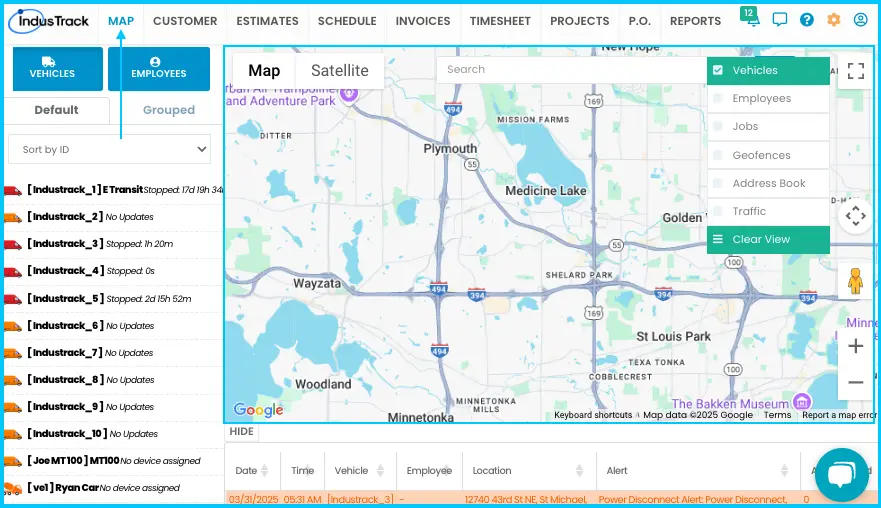
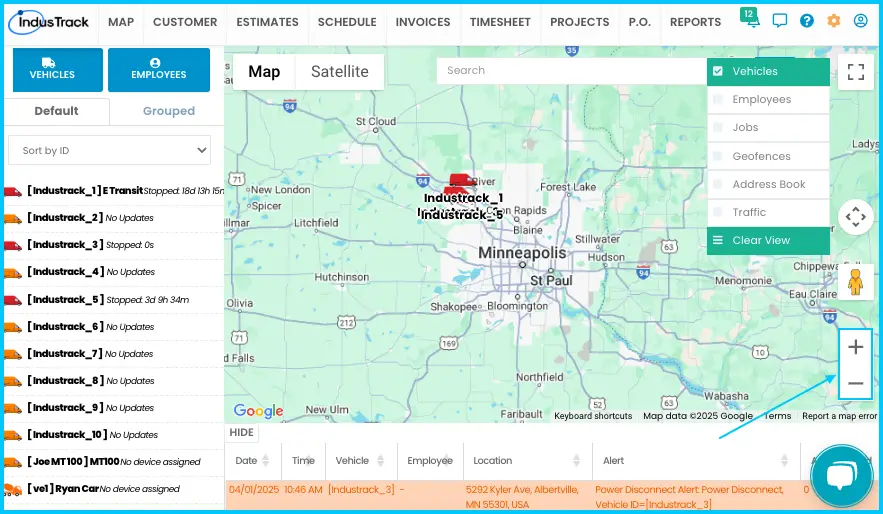
Click Map in the module header. The Map page shows where each vehicle and field employee is right now, with a list of vehicles and employees on the left, the map in the middle, and the alert window at the bottom.
Open the Map page
-
Click Map in the module header.
-
If Map is grayed out or missing, you don't have permission to view it. Ask your system administrator to give you View access for the Map module.
To make the Map your default screen:
- Edit your office user and open the User Preferences tab.
- Under Default starting screen for login, select Map.
The Map page has three parts:
| Part | Where | What it shows |
|---|---|---|
| The list | Left side | Your vehicles and field employees, on the Vehicles and Employees tabs. |
| The map | Center | Real-time locations of vehicles and employees, plus jobs, customers, geofences and traffic when you turn those overlays on. |
| The alert window | Bottom | Vehicle safety alerts. See How do I read the map's alert window? |
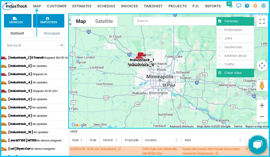
Find a vehicle
Vehicles are tracked with a GPS device. A vehicle without a GPS tracking device doesn't appear on the map.
-
Find the vehicle in one of these ways:
- Type its name or ID in the map's search bar, choose it from the list and click Go.
- On the Vehicles tab of the list, click the vehicle.
- Click the vehicle's icon on the map.
-
The map zooms to the vehicle. Click its icon to open a pop-up with:
- Current location
- Arrival time: when the vehicle arrived at the place where it stopped
- Speed and direction
- How long the vehicle has been there
Watch: Finding a vehicle and opening its pop-up
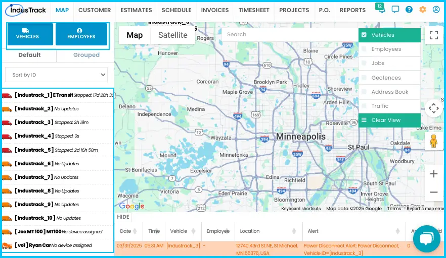
The icon on the left of each vehicle in the list matches the vehicle type set in the vehicle's profile. Its color shows the vehicle's status, and the time next to the name shows how long it has been in that status:
| Color | Status |
|---|---|
| Green | Moving (en route) |
| Blue | Idling |
| Red | Stopped (engine off) |
| Orange | No device, or a device problem. You may need to contact support. |
Get a route for a vehicle
- Click the vehicle's icon on the map, then click Get Route in the pop-up.
- Enter the destination address.
- Click Go.
The map shows the best route from the vehicle's current position to the destination, with the total distance and estimated drive time. To remove the route, click Clear View at the top right.
See where a vehicle has been (last 24 hours)
Click the vehicle's icon on the map, then click Drive History in the pop-up. The vehicle's drive history for the last 24 hours shows on the map as a path.
- Balloon icons are added automatically wherever the vehicle stopped or idled. Click a balloon to see the stop location, time and duration, and the vehicle's status during the stop.
- Arrow icons show direction. Click an arrow to see how fast the vehicle was going at that point.
Find a field employee
Field employees are located by their mobile phone.
-
Find the employee in one of these ways:
- Type their name in the map's search bar, choose them from the list and click Go.
- On the Employees tab of the list, click their name.
-
The map zooms to the employee. Click their icon to open a pop-up showing where they are.
-
To see their jobs on the map, click Show Jobs in the pop-up. It shows the employee's jobs for today.
Watch: Showing an employee's jobs for today -
Click a job icon to see the job location, contact person and a short job description.
Watch: Showing an employee's jobs and opening a job pop-up
To show every field employee at once, turn on the Employees overlay. Each icon shows the employee's name below it. The icon color shows their status, which is also written out in the list:
| Color | Status |
|---|---|
| Green | On duty or working a job |
| Red | Off duty |
| Orange | On a break |
Sort and group the list
Both tabs of the list have two views:
-
Default view: one row per vehicle or employee. Use the drop-down to sort by ID, name or status.
Watch: Sorting the vehicle list by ID, name or status -
Grouped view: click the Grouped tab to see vehicles by vehicle group, or employees by employee group. On the Vehicles tab you can also search by vehicle type or group.
Watch: Viewing vehicles by group Watch: Default and grouped views of the Employees tab
You only see the vehicles you have permission to view.
Use the map controls
-
Search bar: find jobs, customers, geofences, field employees and vehicles. Type a name or address, choose the item and click Go. You can also click a name or icon on the map to see its address.
Watch: Searching for a location on the map -
Street map or satellite: the street map is the default. Click Satellite for satellite images. To show street names and interstate numbers on satellite view, hover over Satellite and check Labels.
Watch: Switching between street map and satellite view -
Street view: drag the Pegman icon onto the map and drop it to open a 360° street-level view. Use rotate to turn, + and – to zoom, and the back arrow to return to the map.
Watch: Opening street view with the Pegman icon -
Zoom: use the + and – buttons.
Turn on overlays
Overlays add information to the map. Turn on as many as you need; they work together.
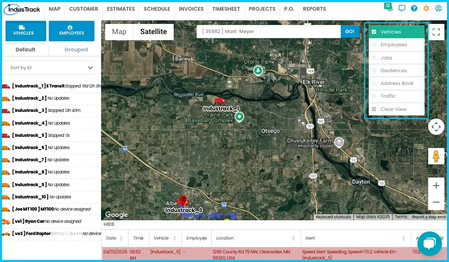
| Overlay | Shows |
|---|---|
| Vehicle | Vehicles with a GPS tracking device. Vehicles are tracked separately from employees. |
| Employee | Field employees, by their phone's location. |
| Address Book | Your customers. Click a customer icon for details. |
| Jobs | Scheduled jobs. Only jobs scheduled in the Scheduling module appear. Click a job icon for details. |
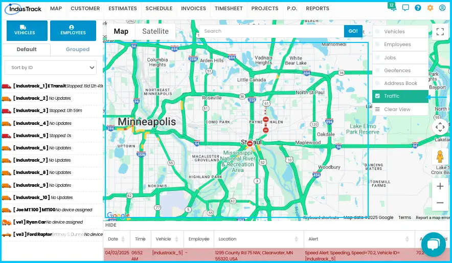
| Traffic | Live traffic flow, construction and road closures, as colored lines (from Google Maps). |
| Geofences | Your geofences (defined zones). |
Useful combinations:
-
Jobs + Vehicle + Employee: job locations along with the assigned team.
-
Geofences + Address Book: customer locations along with your zones.
-
Traffic + Vehicle + Employee: traffic around your crew, to avoid delays.
Find customers near an employee or vehicle
-
Turn on the Employee or Vehicle overlay, or both.
-
Turn on the Address Book overlay.
-
All your employees and vehicles show on the map, together with your customers, so you can see which customers are closest to each one. You don't need to select an employee or vehicle.
Watch: Finding customers near an employee or vehicle
Common questions
Why can't I see the Map?
If Map is grayed out or missing, you don't have View permission for the Map module. Ask your system administrator.
Why doesn't my vehicle show on the map?
A vehicle needs a GPS tracking device assigned to appear on the map or in map searches. See How do I add a vehicle and assign its GPS device? An orange icon means there's no device or a device problem; you may need to contact support.
Why aren't my jobs showing on the map?
Turn on the Jobs overlay. Only jobs scheduled in the Scheduling module appear.
Can I make the Map the first screen I see when I log in?
Yes. Edit your office user, open the User Preferences tab and set Default starting screen for login to Map.
Why is an employee's icon red or orange?
Red means off duty; orange means on a break.
Can I see vehicles and employees together?
Yes. Check both the Vehicle and Employee overlays. If the employee's vehicle has a GPS device, you'll see it next to the employee.
Was this article helpful?
Contact support